The public is encouraged to review the Adopted Bayport Hamlet Study.
Adopted Bayport Hamlet Study
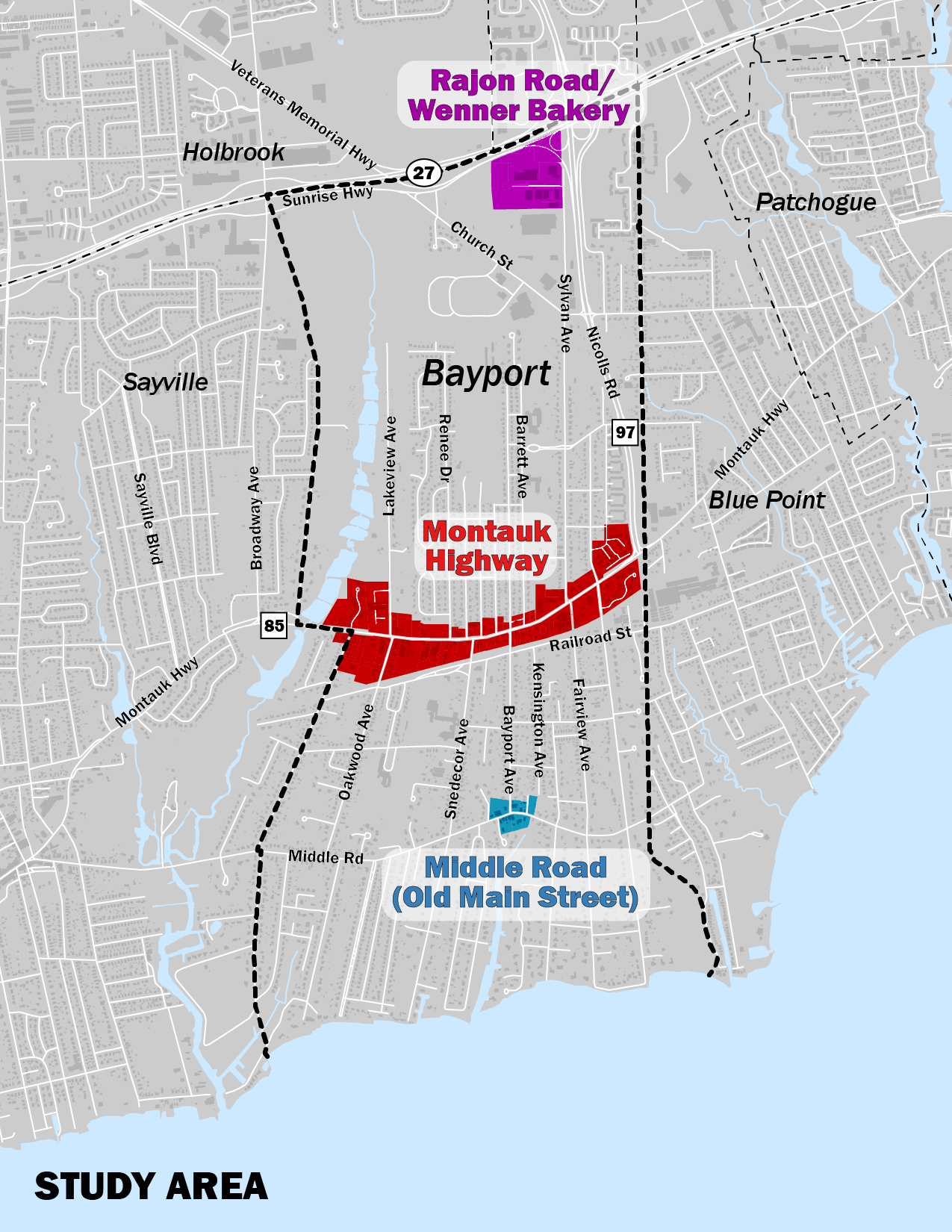
The Town of Islip, recognizing the importance of enhancing the community identity of the Bayport hamlet, commissioned a study to guide development recommendations for its three commercial areas: Montauk Highway, the Industrial area along Rajon Road, and Bayport’s historic hamlet center on Middle Road. Bayport is known as a “Hamlet with a Heritage”, and enjoys a unique charm that its residents seek to maintain. These commercial areas play dual roles, as sources of retail and services for residents and as defining “images” of certain areas of the Hamlet.
It has been 40 years since the last hamlet study was established for Bayport. Since that time, development in the commercial areas has lacked an overall vision, and as a result, planning has been reactionary rather than proactive. Given recent development pressures, particularly along Montauk Highway, the timing was right to identify measures to protect and enhance these business districts, which are an important part of the community fabric.
The purpose of the Bayport Zoning study is to:
- Develop a publicly supported vision for future growth that meets local needs.
- Examine current zoning regulations and define a set of realistic development alternatives and zoning recommendations that considers potential impacts on parking, traffic, safety, aesthetics, infrastructure, community facilities, and other services. The focus for zoning is less about what is happening now and more about what could be developed in the future when businesses change over time.
- Identify design elements that will improve and strengthen each area and improve their relationship with surrounding neighborhoods. Recommendations will be for both private and public property (e.g. roads).
- Develop community supported recommendations to make Montauk Highway a more pedestrian welcoming, retail-active road that supports the desired “Main Street” function.
This plan sets forth a broad and ambitious list of recommendations, zoning district revisions, and design parameters to sustain and revitalize Bayport’s commercial and industrial areas over time. The study identifies the most appropriate mix of uses based on existing land use, past planning initiatives and development proposals, market feasibility, input from local property owners, and availability of essential capital infrastructure.
For Montauk Highway in particular, zoning recommendations provide an economically viable alternative to the existing designation which allows for auto-centric commercial and industrial development. The design guidelines provided for Montauk Highway provide ways to improve the visual character of the corridor, make it more pedestrian-friendly, and better serve its “main street” function for the surrounding community.
The public outreach process was first and foremost about listening to residents and stakeholders and providing them with a forum to share and discuss ideas. A summary of the first public workshop can be found at https://islipny.gov/community-and-services/documents/planning-development. The town also conducted smaller focus group meetings with property owners to discuss issues and opportunities.
Adopted Bayport Hamlet Study